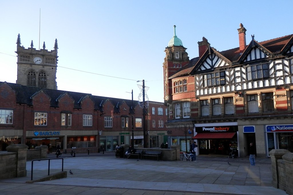
History
Wigan is an ancient town with roots back to early medieval times (see Wikipedia).
There are Roman remains visible in the town centre which are said to be the remains of a settlement known as Coccium (see Roman Britain).
Wigan was incorporated as a Borough in 1246 following the issuing of a Royal Charter by Henry III. All Saints Church (commonly known as Wigan Parish Church) contains fragments of building from the late 13th century.
The population of Wigan expanded with the Industrial Revolution with industries such as Coal Mining, Cotton Manufacturing and Engineering. This led to the development of many local districts and the absorbing of smaller villages. Many people migrated from rural districts such as Winstanley Wigan and Skelmersdale into Wigan, including several ancestors.
Transport Links
In order to make exporting of coal easier the River Douglas was canalised in the 1740s from Wigan to the River Ribble and was known as the Douglas Navigation.
The Leeds And Liverpool Canal was built to the north and east of the town and down around the town centre, opening in 1816. The canal around the Pottery neighbourhood of Wallgate Wigan was the location for the famous Wigan Pier.
Prior to the building of steam driven public railways in the 1830s many collieries built their own private railway lines (driven by primitive steam engines or horse power) to connect the coal mines to the nearest canal, such as the line that connected the Orrell Colliery at Winstanley to the canal in 1812.
The Haigh Foundry at Leyland Mill Lane was responsible for building several early railway engines in the 1810s, for private colliery lines.
Starting in 1831 various public railways were built through and around Wigan (see Wikipedia). This started with the Wigan Branch Railway which linked the Liverpool and Manchester Railway to Wigan with a Terminus at Chapel Lane. The Wigan Branch Railway was merged into the North Union Railway in 1834 and extended to Preston. At this point the Chapel Lane Terminus was converted into a goods station and a new station established where the North Western Station now exists. This line became the west coast main line. In 1848 the Lancashire and Yorkshire Railway was opened in Wigan with a station on Wallgate. In 1892 the Wigan Junction Railways reached Wigan with a Terminus at Wigan Central Station, which closed in 1965.
The private Winstanley Colliery line that reached the Leeds And Liverpool Canal at Wigan Pier was completed in 1845 (see Historic Society Of Lancashire And Cheshire for more information).
Neighbourhoods
This is a modern map of the Wigan area with the major neighbourhoods noted (see Open Street Map)
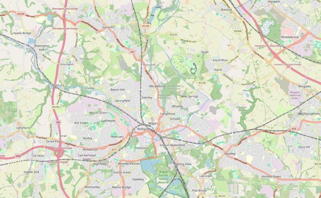
- Central Wigan the historic centre of Wigan
- Whitley northern most neighbourhood of Wigan, residential
- Swinley neighbourhood to immediate north of Central Wigan, residential and commercial
- Whelley neighbourhood to the north east of Central Wigan, residential
- New Springs neighbourhood to the north east of Whelley, residential
- Scholes neighbourhood to immediate east of Central Wigan, residential and commercial
- Ince neighbourhood to south east of Central Wigan, residential, commercial and industrial
- Wallgate neighbourhood to immediate south of Central Wigan, commercial.
- Poolstock neighbourhood to the south of Central Wigan, residential
- Worsley Mesnes southernmost neighbourhood of Central Wigan, residential
- Winstanley neighbourhood to south west of Central Wigan, residential
- Orrell Post westernmost neighbourhood of Central Wigan, residential
- Kitt Green neighbourhood to west of Central Wigan, residential and industrial
- Pemberton neighbourhood to west of Central Wigan, residential and commercial
- Newtown neighbourhood to west of Central Wigan, residential
- Beech Hill neighbourhood to the north west of Central Wigan, residential
- Springfield neighbourhood to the west of Central Wigan, residential
Surrounding Villages And Towns
As well as the neighbourhoods of the Wigan urban area there are several villages and towns separated from Wigan by countryside that are considered to be in Wigan’s “sphere of influence” for the purposes of this web site. They may be in the Wigan Council area or they may be in neighbouring areas.
These are the villages and towns that ancestors lived or worked in
- Chorley small town to the north of Wigan
- Coppull village to the north of Wigan
- Standish small town the immediate north of Wigan
- Horwich small town to the north east of Wigan
- Blackrod village to the north east of Wigan
- Haigh village to the north east of Wigan
- Aspull village to the north east of Wigan
- Atherton small town to the east of Wigan
- Westhoughton small town to the east of Wigan
- Hindley small town to the immediate east of Wigan
- Leigh town to the south east of Wigan
- Abram village to the south east of Wigan
- Platt Bridge small town to the south east of Wigan
- Spring View small town to the south east of Wigan
- Orrell small town to the west of Wigan
- Aughton village to the west of Wigan
- Ormskirk town to the west of Wigan
- Skelmersdale town to the west of Wigan
- Upholland village to the west of Wigan
- Dalton hamlet to the north west of Wigan
- Parbold village to the north west of Wigan
- Appley Bridge village to the north west of Wigan
- Shevington village to the north west of Wigan
- Gathurst hamlet to the north west of Wigan
Some major towns further afield also have a part in the ancestor stories.
