(See St Helens for overview of the whole town)
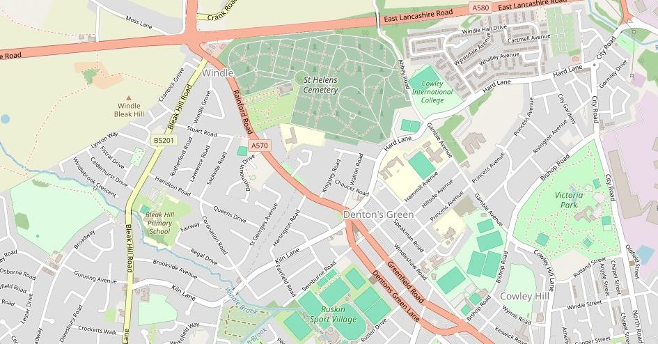
Windle is one of the four ancient townships that make up the modern town of St Helens. Windle is in the north west of the current St Helens. Windle was a rural area that included the ancient Windlesham Abbey, Denton’s Green in the centre, City Windle St Helens to the east and the more urbanised district of Hardshaw to the south which had the ancient chapel of St Elyn that gave the name St Helens to the modern town.
Hardshaw became the modern town centre of St Helens and the north of the ancient Windle became what is referred to as Windle today.
This map from 1850 shows the original area around Denton’s Green
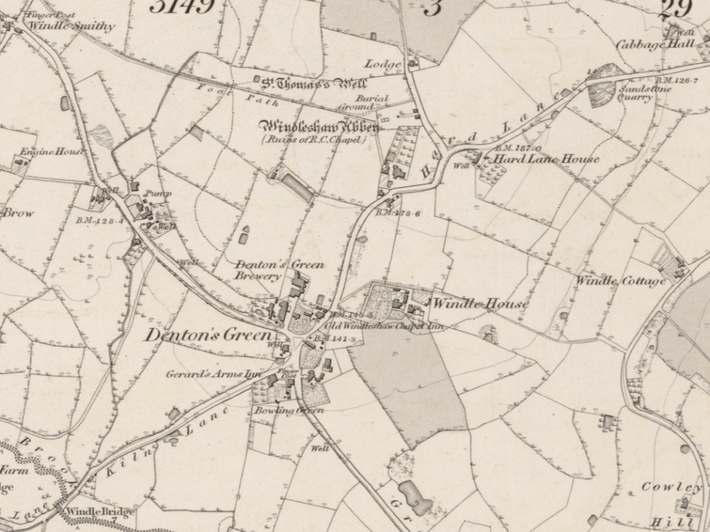
Notable locations on the map are as follows (relative to Denton’s Green)
- Ruins of Windlesham Abbey to the north
- Going north east is Hard Lane
- At end of Hard Lane is Cabbage Hall which was the residence of Littler families
- To east is Windle House and then Windle Cottage
- To south east is Green Lane
- At end of Green Lane is Green Lane Colliery
- To south west is Kiln Lane
- Along Kiln Lane is Windle Bridge over the Windle Brook
- To north west is an unnamed road
- Unnamed road leads to Windle Smithy, Windle Ashes and Windle Colliery
This is a continuation of the above map to the east into what is believed to be the City Windle St Helens area
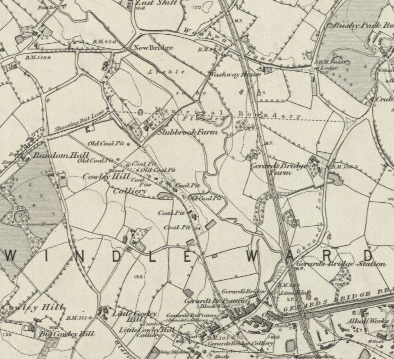
Notable locations are as follows
- The northernmost road is a continuation of Hard Lane, which leads to New Bridge.
- The next road south runs to the north of Windlehurst whose grounds became Victoria Park
- The road runs into Shooting But Lane which became Windle City
There are many mentions of “City Windle” in early certificates and investigation done to generate this web site suggests that this was the area around Hard Lane and Windlehurst.
St Mark is a church to the south of Victoria Park.
See Wikipedia for more information.
Many ancestors originated in Windle as farmers before dispersing into other areas of St Helens.
