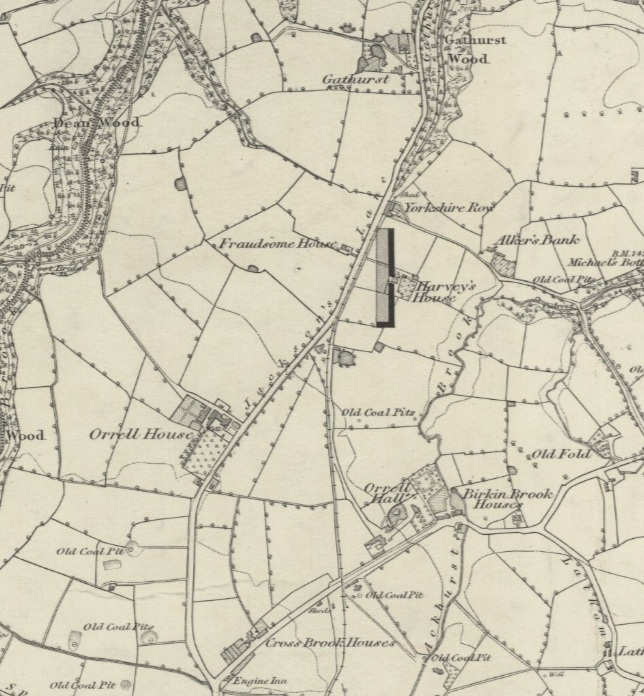
In the 1861 census Thomas Barton and his brother John were working in a farm at Orrell Post farmed by their aunt Alice Gorse (nee Mawdsley). This is transcribed as “Farm Orrell House Orrell Post”. There is a modern farm called “Orrell House Farm” near Gathurst (see Transparent Farms UK) and there is an “Orrell House” at the same location in the 1848 map (where modern Gathurst Road is marked as Jackson’s Lane, but marked as Jackson’s Road in the 1892 map).
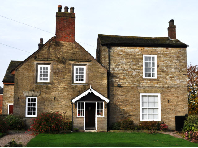
This is a modern photo of the farm.
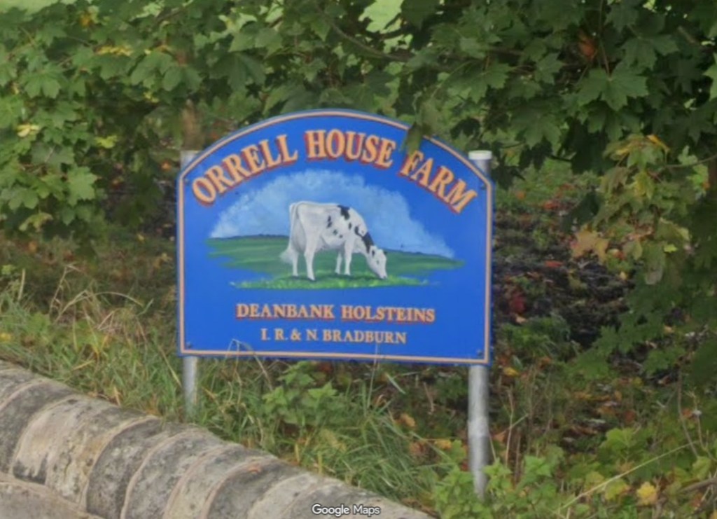
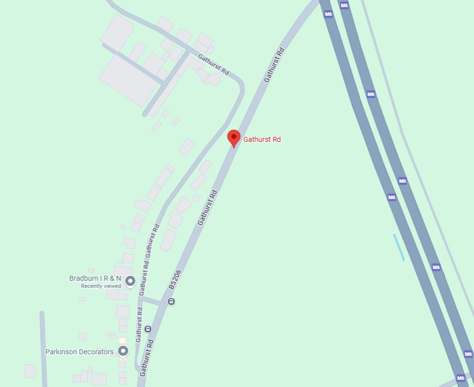
This is a modern map of the farm’s location (unmarked at the top of the map). The original Gathurst Road was split into a residential cul-de-sac with the farm at the end and a non-residential main road when the M6 motorway was built nearby. Coincidentally the root of this family tree Norman Barton (descendant of Thomas Barton) lived in this same cul-de-sac from 1935 to 1993 and one of his daughters remembers going to the Orrell House Farm to look after the child of the farmer.
It is possible that the property with the transcription “Farm Orrell House Orrell Post” is the “Orrell House” on the 1848 map (and the modern “Orrell House Farm”) even though the modern location may not strictly be referred to as Orrell Post.
This can be confirmed by looking at the 1861 census entries around the “Farm Orrell House Orrell Post” entry and thereby deducing the order in which properties where visited by the census enumerator when collecting the census forms. The census images show the following
- Page 31
- Farmoor
- James Green Nailmaker
- ditto
- Moses White
- Orrell Post
- Ann Silcock
- ditto
- Alice Taberner Provision Dealer
- Stag ditto Farm
- Henry Nixon Farmer + Publican
- Red Lion
- William Fishwick Victualler
- Farmoor
- Page 32
- Many entries for Orrell Post (no road numbers or house names)
- John Berry Cannell Miner
- Edmund Smith Stone Quarrier
- Alice Taberner Grocer
- Thomas Rowbottom Agricultural Labourer
- John Lever Coal Miner
- Henry Gorse Farmer aged 60 (some relative of Alice Gorse’s dead husband?)
- Many entries for Orrell Post (no road numbers or house names)
- Page 33
- Orrell Post
- James Pickering Coal Agent
- Farm ditto House (so “Farm Orrell Post House”)
- Thomas Alker Farmer 33 Acres Aged 28
- in 1871 census he was still a farmer living at “Moor Cottage” which could be the “Moore House” in the 1894 map which was just north of Stag Inn
- Thomas Alker Farmer 33 Acres Aged 28
- ditto ditto (so “Farm Orrell Post” not “Farm Orrell Post House“?)
- Alice Gorse Farmer 30 Acres Aged 39, Thomas Barton Servant, John Barton Servant
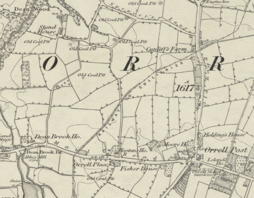
- In the 1838 Tithe Maps a Thomas Gorse occupies many plots around Orrell Post, as does a Thomas “Grose” which is likely to be a mis-entry for Thomas Gorse by the original scribe as no such person exists in the 1841 census. This Thomas is likely to be the father of the Thomas that will marry Alice
- In the 1841 census a Thomas Gorse lives at “Hooton House” (between Orrell Post and Dean Brook, directly across the road from Orrell Place) with his son Thomas. The son will marry Alice.
- In the 1851 census Alice Gorse is living at “Road To Upholland” with her Farmer husband Thomas and family which matches the 1861 census as a farm before Dean Brook (a Henry Gorse, brother or uncle?, is living at Dean Brook House)
- Alice’s son Thomas is born in 1854 at “Moor House Orrell” which is on the 1848 map nearer to Orrell Post
- Alice’s daughter Jane is born in 1856 at “Moore? House Orrell”
- Alice’s daughter Catherine is born in 1858 at “Near Orrell Post”
- Alice’s husband Thomas died in 1859 at “Boothies? Place Orrell” of erysipelas (skin infection) and “effusion on the brain”. This location does not match anything on the 1848 map, but since his final illness had a duration of 6 days he probably died at home so this could have been the name of the farm, possibly another name for “Orrell Place“? the family could have moved from “Moor House” to “Boothies Place”
- In the 1871 census Alice Gorse is living at 2 Ormskirk Road Pemberton as a Housekeeper so has given up the farm and moved away
- Alice Gorse Farmer 30 Acres Aged 39, Thomas Barton Servant, John Barton Servant
- Orrell Post
- Page 34
- Dean Brook B??? could be Bridge (it is transcribed as “Brown” which is dubious) (Dean Brook is west of Orrell Post)
- William Bold Wheelwright
- ditto
- Richard Rylands Farmer
- Stand House (which is north west of Orrell Post)
- William Holcroft Farmer 22 Acres
- “below Orrell Post”
- Mary Silcock Cotton Weaver
- ditto
- George Parkinson Coal Miner
- Dean Brook B??? could be Bridge (it is transcribed as “Brown” which is dubious) (Dean Brook is west of Orrell Post)
- Page 35
- lots of “below Orrell Post”
- John Gerrard Carpenter
- Mary Broxton
- Sarah Latham Labourer
- Thomas Latham Coal Miner
- John Deakin Coal Miner
- lots of “below Orrell Post”
- Page 36
- “below Orrell Post”
- Thomas Howarth Coal Miner
- ditto
- James Criggan Agricultural Labourer
- Jackson’s Lane
- Peter Ball Farmer 30 Acres Aged 46 (suspect this is Orrell House)
- in the 1851 Census Peter Ball was farming at Stand House
- Peter Ball Farmer 30 Acres Aged 46 (suspect this is Orrell House)
- ditto
- John Green Agricultural Labourer
- ditto
- Thomas Fishwick Agricultural Labourer
- “below Orrell Post”
- Pages 37 and 38 missing
- Page 39
- unknown
- Gathurst Brow
- William Gore Coal Miner
- Dean Wood
- George Eastham Coal Miner
From the above it looks like the census enumerator’s journey was as follows
- from south of Orrell Post (known as Far Moor) north to Orrell Post
- from Orrell Post west to Dean Brook
- from Dean Brook north to Stand House
- from Stand House east to Jackson’s Lane
- from Jackson’s Lane north to Gathurst
The transcription of “Farm Orrell House Orrell Post” is deduced from the “ditto” markings on the original document and the result is questionable, the real name could be just “Farm Orrell Post”.
The actual location is theoretically deducable from the order of the census entries. Alice Gorse’s farm is just before Dean Brook and is not in Jackson’s Lane (Peter Ball’s farm is there and is likely to be the actual Orrell House Farm) so is more likely to be one of the properties around Orrell Place and Hootan’s House since they are before Dean Brook House on the enumerator’s route.
