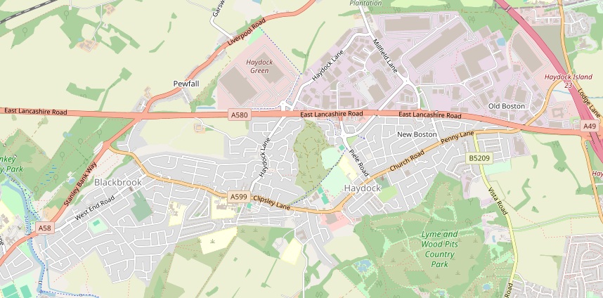
Haydock is a small town to the north east of St Helens, from which it is separated by the St Helens Canal. To the north of Haydock are Garswood and Ashton In Makerfield. The parish church of Haydock is St James The Great.
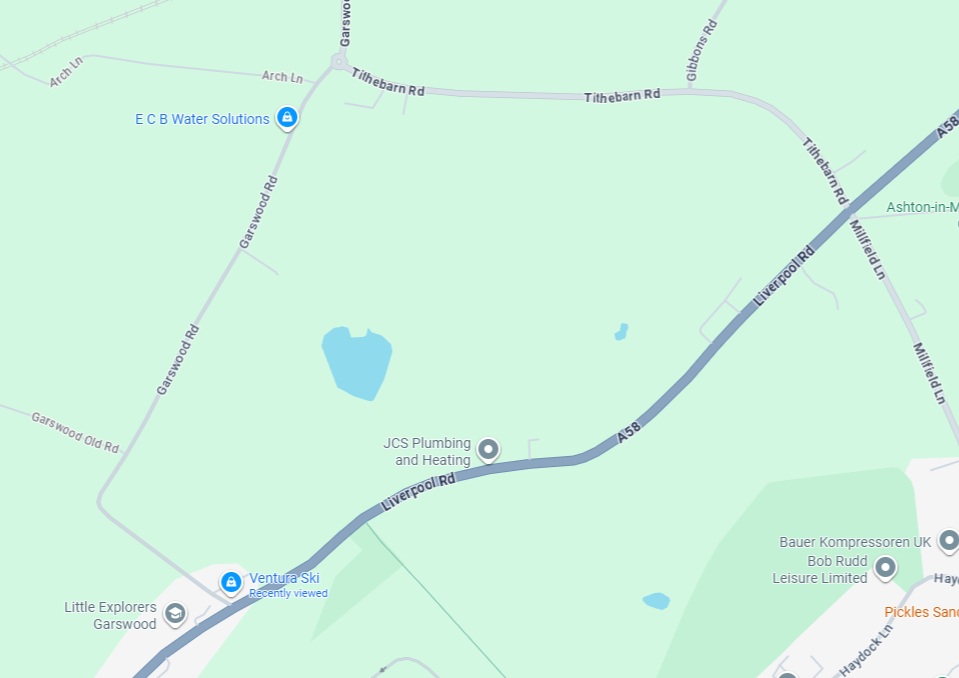
The rural area between Haydock and Garswood is known as Pewfall, where there once was a colliery.
See Wikipedia for more information.
Various ancestors lived in Haydock, such as John And Hannah Heaton.
These are some of the roads referred to in certificates and censuses
- Slag Lane: runs from Liverpool Road into Haydock, south of Pewfall
- Robinson’s Lane: not found on modern maps. A Wigan Corporation Document on footpath rights of way states “Old Pewfall Colliery footpath from Liverpool Road to Robinsons Lane”. The 1848 map of Lancashire shows that Robinson’s Lane was in fact the old name for the modern Garswood Road.
- Lower Lane: not found on modern maps. The 1848 map of Lancashire shows that Lower Lane was the old name for the modern Liverpool Road. According to census returns this change happened between 1901 and 1911.
- Tithebarn Road: this used to be called Tithe Barn Lane and runs to north of Pewfall from Garswood Road (Robinsons Lane as was) to Liverpool Road (Lower Lane as was)
- John and Hannah Heaton and their descendants lived at 202 Tithebarn Road for more than 50 years
- Mill Lane: not found on modern maps, it is an old or local name for Millfield Lane which existed with that name in the 1848 map, running on from Tithebarn Road after the crossroads with Liverpool Road (Lower Lane as was). Within the John And Martha Houghton family there are references to Mill Lane in certificates until the end of 1853, followed by references to Millfield Lane by 1856, however the 1851 census has the family living at Mill Field Lane which shows that the same road was referred to by both names at this time (since later certificates use the name Mill Lane).