The location “City Windle” appears in many early certificates. It is unclear whether this refers to the Hardshaw district around St Helen church within Windle St Helens or to the area to the north of the modern Victoria Park (itself north of the town centre), where there are modern streets named “Windle City” and “City Gardens”. There is also a modern main road called “City Road” which terminates at Victoria Park.
The birth certificate of Elizabeth Brown states she was born in “City Windle” but her baptism record transcript says “Hard Lane Windle” (though the image of the record is so faint that it is unreadable), and “Hard Lane” is in the north of Windle not in the Hardshaw district to the south. Also Elizabeth’s family Thomas and Elizabeth initially give addresses as “City Windle” but later gave specific addresses in the area around the modern “Windle City” and “City Gardens” immediately north of Victoria so it seems likely that that area is the historical “City Windle”, and not Hardshaw.
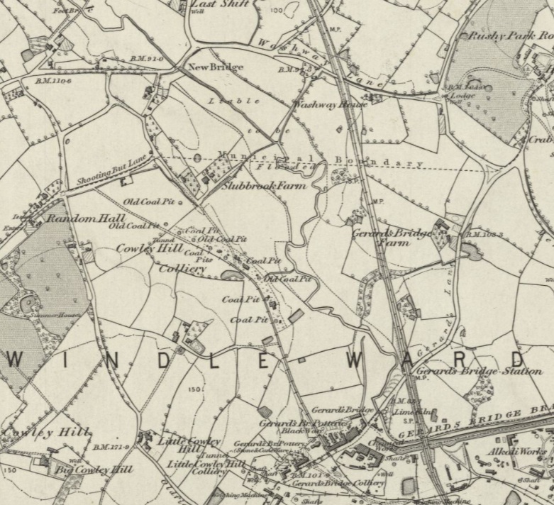
This is the 1850 map. The northermost road on the west is Hard Lane. The parkland area below is a private estate but will become Victoria Park. The Road called Shooting But Lane to the north west of the parkland will be renamed “Windle City”.
This is a modern street map of the area
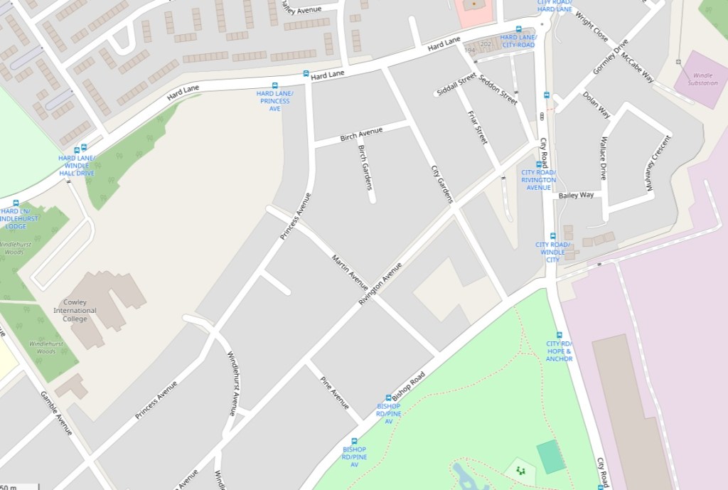
The unnamed road at the north west of Victoria Park is Windle City road, which is now an unused road. The road “City Gardens” did not exist in 1892 (when the 1894 map was surveyed) but did exist in 1897 when a Littler relative was born there, so presumable that whole network of street to the west of “Windle City” was built between 1892 and 1897.
